- /
- Katun Road Untold Bjelasica
- /
- History
History
People have lived on Bjelasica and its foothill since the ancient times. This can be confirmed by findings from prehistory, the remnants of the fortifications and settlements, old graveyards, churches, names of the rivers and mountains, villages and katuns, legends and folk tales. Illyrian tribes lived here before Greeks and Romans. Then the Slavs came, and after them, Turks. All the people living on Bjelasica were engaged in cattle breeding because they had perfect conditions, and some were miners, because they knew that the mountain was favorable, inside and outside.
From the prehistory
Several sites here are related to the prehistoric period. The remnants of the material culture found in Majstorovina, a village situated on the northern slopes of Bjelasica, prove that the life here was developed in the newer Stone Age. A tongue-shaped hand axe found here dates back to 10,000 years BC.
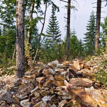
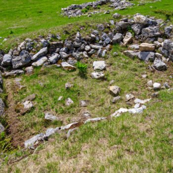
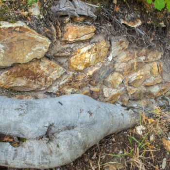
The first primitive fortifications were built in the Bronze Age, looking like towns, and are still known as forts today. They were usually drywalls. These forts can be seen in several places, and the one situated in the heart of the national park is called Gradac.
At the beginning of historical period, members of the Illyrian tribe Autariatae lived in the area of Bjelasica, and later Kriči, Macuri, Bukumiri emerged from them.
Illyrian sanctuaries were located under the open sky. Numerous toponyms and names of villages, such as Trebaljevo, Trepča, Trebin krš, Trijebine … originated in Trebnik, a place where sacrifices were made to the gods (rooster, lamb, calf). These were the pagan altars of the Illyrians and Slavs, until the adoption of Christianity.
The highest peaks of Bjelasica, Crna glava (2139 m) and Troglava (2072) were named after the Old Slavic gods Crni bog and Troglav.
Roman rule
The Romans had been trying to conquer Illyrian territories for 300 years and when they succeeded, they ruled over them for 500 years. They renamed Illyricum into a Roman province Dalmatia. The river Lim valley became the border of the Roman province Praevalitana or Prevalis, and this region of Bjelasica was a home to about twenty Roman towns, up until the invasion of Goths and then, Slavs.
Graveyards from the Roman period are called Latin graveyard by the people. There are several of them, especially on the eastern slopes of the mountain. Some of these graveyards may have belonged to later colonies of Kotor, Dubrovnik or Saxons, but they were all Latins for our orthodox ancestors.
Mining
Traces of mining can be seen all around Bjelasica. Numerous toponyms left behind Kriči, Bukumire, Macure, Romans and Serbs indicate this is true. In the Middle Ages, mining shafts were called holes, and miners were named hole diggers.
The Romans had a modern technology for the exploitation of zinc-lead and silver-gold ore. Serbian medieval rulers were mostly interested in silver and, since Slavs were not skilled in mining, they invited a large number of Saxons to help them.
In the area of the village Bastahe, in Bistrica canyon, a site called Šalitrište can be found. One of the caves is called Šalitrača. They used to excavate saltpeter or nitrate for gunpowder there.
Olovo, a place where led ore was mined and processed, is located in Prijelozi. The river Svinjača is situated on the western part of the mountain and its name originates from the old Slav word svinjec which means led.
Mining also helped the development of craftsmanship. There are several places called Vignjište and one which is called Madžgaljica on Bjelasica, both are associated to blacksmithing.
Ancient and medieval towns
Samograd
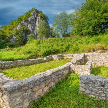
Samograd or Kamengrad or a town-between-seven-pillars, is an ancient fortress from the 4th century AD. It is situated on the river Brzava, around 4.5 kilometers away from its confluence to the river Lim, between seven pillars (4 larger and 3 smaller) – rocks whose height goes from 30 to 80 meters, and the narrow passages between these were closed by drywalls of coarse, crushed limestone. Samograd is a rare example of natural fortress. The rocks are set in a circle so they look like the spikes on a royal crown.
The remains of an early Christian Basilica built in the 4th and restored in the 6th century AD, can be found in the town. Samograd was a spiritual center in the times of Nemanjić dynasty, up to the arrival of Turks in 1451.
During the recent research of the site, some valuable exhibits were found, such as the remains of the pottery from the Bronze and Iron Age, which proves that the life in Samograd, in this quiet place between the seven pillars, had been continuously going on from the year 1,000 BC up to the 6th century AD. The spiritual life of this ancient settlement is slowly rebuilding. A church made of logs was built close to the ramparts.
Medon
A town called Medon was located in the southern part of the mountain, on Bačko hill, between Zminica and Lisa. A katun called Medni Do was named after this town and the town itself got its name from the ore – copper, which was melted there.
There is a legend passing among people of Rečinski region that the town sank during an earthquake. The road of emperor Dušan passed by this town. The remains of a church and wedding graveyard can be seen nearby.
The river Gradišnica, left tributary of Lim, was named in the Middle Ages because it was believed that it rose from the terrain under the town Medin. In the middle course of the river, below Konjsko, there is an old graveyard and some ruins. This site is called Ravna Gradinica.
Brskovo
Brskovo spanned across the northern slopes of Bjelasica, the part spreading from Mojkovac towards Brzava, which were also parts of the parish which bore the same name.
But specific location of Brskovo, where the old mine used to be and whose outlines can be seen even today, is the area between the rivers Rudnica and Bjelojevićka, right tributaries of the river Tara.
Since they lacked mining experts then, king Uroš Nemanjić solved the problem by inviting Saxon miners to Brskovo. Brskovo was first introduced in the trade Charter of the king Stefan the First-Crowned addressed to Dubrovnik, between 1219 and 1228. According to Jirecek, it was the oldest medieval square. The town was visited by many Kotor and Dubrovnik merchants. It used to have the silver mine, a mint and a Dominican church dedicated to the Holy Mother of God, which was also called Saxon church among the people. In 1280, the prince od Brskovo was a Saxon called Frieberger. Saxons had their own court in Brskovo (Kuria teotonikorum). Since the trials took place in the mountain, away from the settlement, court houses were situated in the village of Kurikuće (court houses).
During its golden ages, Brskovo had a custom office, it was a Dubrovnik colony and it was the place where a Dubrovnik consul lived. Money called “Grossi de Brescova” was minted in Brskovo.
In 1399, the Turks took Brskovo, and according to Dubrovnik sources, in 1433 it was an abandoned place.
Old roads
In Roman times, the valleys of Lim and Tara accommodated a road which was of great military and commercial importance. The memory of those old roads is contained in the names: Macurski road and Latin road in the villages of Kralje and Gnjili Potok, Latin roadway in Zaostro and Roman road in the village of Kurikuće.
Roman roads that descended from Komovi, on the right side of the river Tara and left side of the river Lim, met at Brzava. Caravans passed along these roads even in the Middle Ages. It was a so-called Zeta Road (Via Zenta).
The road of emperor Dušan stretched along the wreath Šiška – Zekova Glava – Raskrsnica – Krivi do, Bačko Brdo – Lisa- Trešnjevik and beyond. There are some traces of this road even today. This road had its customs office. The hill Ćupovi reminds us of this, since it had a jar at its foothill, where caravan would leave a coin when passing by.
Bjelasica was also a home to a road of king Nikola Petrović. Before the Balkan war, by the king’s order, a road was built from Kolašin via Mušovica river, along the Paljevinska river, across Jezerine and Raskrsnica, the watershed of Tara and Lim basins and it descended into Griže, which was then a Turkish border. The wars of 1912 prevented the connection of Kolašin and Berane nahiyah.
In 1935, the caravan road from Berane to Jelovica was built by the people’s will. A new drive along the same route was built in 1956, and only in the 60s it was connected to Raskrsnica under the name of forest road.


